Scheduled Downtime
On Tuesday 24 October 2023 @ 5pm MT the forums will be in read only mode in preparation for the downtime. On Wednesday 25 October 2023 @ 5am MT, this website will be down for maintenance and expected to return online later in the morning.
Normal Operations
The forums are back online with normal operations. If you notice any issues or errors related to the forums, please reach out to help@ucar.edu

Inquiry about Simulating Runoff with CLM5.0

Status
Not open for further replies.

Zhengjy

Zhengjy
New Member
Hello everyone,

I am currently using CLM5.0 to simulate watershed runoff on the Qinghai-Tibet Plateau in China and have encountered some issues. Hydrological stations are typically set up at the end of a river to observe the river's runoff . The outputs I have set in the model are QRUNOFF, QDRAI, QOVER, and QH2OSFC.

My questions are as follows:
1. I am unsure which variable or combination of variables corresponds to the observed data from the hydrological stations. I have referred to some literature, with some suggesting QOVER + QDRAI, and others suggesting QOVER + QDRAI + QDRAI_PERCH. Could you help me determine which is accurate? Thank you.
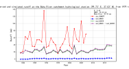
2. Using the QOVER + QDRAI method, I first obtained the observed annual runoff depth (mm) from the hydrological stations, then simulated and extracted QOVER, QDRAI, and QOVER + QDRAI at the coordinates of the hydrological stations. I found that while the fluctuations were reasonable, there was a significant numerical difference, mainly because QDRAI values were almost negligible. Why is this happening?

These issues are quite confusing to me, and I hope to get some help here. Thank you very much!

Best regards,
 

Attachments

  • obs & mod runoff.png
    obs & mod runoff.png
    473.6 KB · Views: 14

Zhengjy

Zhengjy
New Member
You may find this section and other sections of the CLM Technical Note useful in trying to answer your questions:
Thank you for your advice, but I still don't understand it after reading the corresponding chapter. Maybe I don't have the expertise in hydrology. I am a meteorologist. Can you tell me which variables should I use to correspond to the runoff depth observed at the hydrological station? Is it QOVER+QDRIN?
 

slevis

Moderator
Staff member
I don't know the answer to your question, but I found another thread that may offer insights:
 

Zhengjy

Zhengjy
New Member
I don't know the answer to your question, but I found another thread that may offer insights:
OK, thank you for your help, this problem has not been solved yet, I will check the information again.
 

slevis

Moderator
Staff member
Hello,
I looked at your questions again and have some thoughts:
1) Since you have found literature suggesting using QOVER + QDRAI + QDRAI_PERCH, then I think you should try it in case it helps with the underestimation shown in your figure.
2) So maybe (1) will explain (2). But also, how do you define observed runoff? If it's river flow, then you may need to look at simulated river flow rather than QOVER, QDRAI, and QDRAI_PERCH.
 

Zhengjy

Zhengjy
New Member
Thank you for your suggestion, slevis. I have checked the relevant literature and determined that the hydrological station observes the river flow (m³/s), which is converted into runoff depth (mm/s) by dividing it by the catchment area, and can be compared with the CLM simulation results. Several papers have shown that the Surface runoff (QOVER) + Sub-surface runoff (QDRAI) simulated by CLM has the same physical meaning as the observed runoff depth, so they can be compared.

The picture I gave above is a similar comparison, and it is found that the QDRAI is almost 0 every year, resulting in a large deviation from the observation, which has not yet been reasonably resolved. If follow your thinking and directly compare the river flow, what is the name of the variable output by the CLM simulation? This may be another solution to verify the simulation results.
Hello,
I looked at your questions again and have some thoughts:
1) Since you have found literature suggesting using QOVER + QDRAI + QDRAI_PERCH, then I think you should try it in case it helps with the underestimation shown in your figure.
2) So maybe (1) will explain (2). But also, how do you define observed runoff? If it's river flow, then you may need to look at simulated river flow rather than QOVER, QDRAI, and QDRAI_PERCH.
 

slevis

Moderator
Staff member
From your first post I now realize that you are likely running regional simulations. If so, then you cannot look at simulated river flow variables, because the clm river transport model works only for global simulations. This means that you have already been doing what you should.

If simulated QDRAI is underestimated, you may possibly increase it by changing the model's input soil texture in the grid cell of interest. You should find input soil texture data in the fsurdat file that you are using.
 
Status
Not open for further replies.
Top