-
The www2.cesm.ucar.edu website is currently down for maintenance
You are using an out of date browser. It may not display this or other websites correctly.
You should upgrade or use an alternative browser.
You should upgrade or use an alternative browser.
Longitude data
- Thread starter TCNasa
- Start date
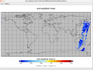
I am using CAM. However, my longitude parameter (Lon) in my output history file is set from 1-360. This is inconsistent with my latitude parameter (lat) which is -90 to 90. How can I change my output longitude to to -180 to 180 for correct plotting?
What plotting software are you using?
I am using Panoply. When I plot the "lon" field of my cam history file, it shows 1..360, but the "lat" field shows -90..90. This causes my plot to shift longitudinally.
I'm not familiar with Panoply, but longitude are cyclic, so it should be able to plot your data with any longitude range.
I mean it should be at +90 but is listed at 270
Can you provide a screenshot that uses a field that's obviously incorrectly shifted?
I can't upload. File too large
The screenshot is too large? Can you reduce its size?
No I can't.
Please email me the screenshot, then. Thanks!
Panoply is not the problem. The contents of the "lon" array in the CAM history file need to be -180 to 180 instead of 0 to 360. I don't know how to specify this.
Perhaps someone who uses Panoply can chime in.


