Scheduled Downtime
On Tuesday 24 October 2023 @ 5pm MT the forums will be in read only mode in preparation for the downtime. On Wednesday 25 October 2023 @ 5am MT, this website will be down for maintenance and expected to return online later in the morning.
Normal Operations
The forums are back online with normal operations. If you notice any issues or errors related to the forums, please reach out to help@ucar.edu

Where can I look for the surface data for 2018

Status
Not open for further replies.

AnuNTNU

Anusha Sathyanadh
New Member
Hello Everyone.

I am trying to run a NorESM atmosphere only simulation (NF2018fsstfrc2) where the land model data is fixed at 2018. But I can see the surfacedata available only for 1850 and 2000. Can someone help me to find/create the data for 2018 or please let me know if you have any suggestions
 

oleson

Keith Oleson
CSEG and Liaisons
Staff member
@erik do you have a process for this? I assume one would need to select an SSP and then generate that specific year using mksurfdata_map.
 
Last edited:

oleson

Keith Oleson
CSEG and Liaisons
Staff member
I haven't heard anything more about how to do this, so I tried the following. I picked SSP585.

Generate a surface dataset for a specific year (e.g., 2018) for SSP585 with release-cesm2.1.3:

./mksurfdata.pl -res 0.9x1.25 -ssp_rcp SSP5-8.5 -years 1850 -debug

Then:

cp surfdata_0.9x1.25_SSP5-8.5_78pfts_CMIP6_simyr1850_c221207.namelist surfdata_0.9x1.25_SSP5-8.5_78pfts_CMIP6_simyr2018_c221207.namelist

Then edit surfdata_0.9x1.25_SSP5-8.5_78pfts_CMIP6_simyr2018_c221207.namelist as:

mksrf_fvegtyp = '/glade/p/cesm/cseg/inputdata/lnd/clm2/rawdata/pftcftdynharv.0.25x0.25.SSP5-8.5.simyr2016-2100.c171005/mksrf_landuse_SSP5RCP85_clm5_2018.c171005.nc'

mksrf_fhrvtyp ='/glade/p/cesm/cseg/inputdata/lnd/clm2/rawdata/pftcftdynharv.0.25x0.25.SSP5-8.5.simyr2016-2100.c171005/mksrf_landuse_SSP5RCP85_clm5_2018.c171005.nc'

fsurdat = 'surfdata_0.9x1.25_SSP5-8.5_78pfts_CMIP6_simyr2018_c221207.nc'

fsurlog = 'surfdata_0.9x1.25_SSP5-8.5_78pfts_CMIP6_simyr2018_c221207.log'

Then:

./mksurfdata_map < surfdata_0.9x1.25_SSP5-8.5_78pfts_CMIP6_simyr2018_c221207.namelist

The result was:

surfdata_0.9x1.25_SSP5-8.5_78pfts_CMIP6_simyr2018_c221207.nc
 

AnuNTNU

Anusha Sathyanadh
New Member
./mksurfdata.pl -res 0.9x1.25 -ssp_rcp SSP5-8.5 -years 1850 -debug
When I tied to do this, I get the below error
(base) [a2021@login-2.FRAM /cluster/projects/nn9576k/NorESM/noresm2.0/components/clm/tools/mksurfdata_map]$ ./mksurfdata.pl -res 0.9x1.25 -ssp_rcp SSP3-7.0 -years 1850 -debug
** Invalid simulation year: 1850
 

oleson

Keith Oleson
CSEG and Liaisons
Staff member
What version of CESM/CLM/CTSM are you using? It works here for the two supported versions of CESM (release-cesm2.1.3 and release-cesm2.2.0).
 

AnuNTNU

Anusha Sathyanadh
New Member
Thanks for the reply.
I used noresm2.0. I just tried it from CESM version 2 also, then i get a different error, pasted below
[a2021@login-2.BETZY /cluster/projects/nn9576k/CESM2/components/clm/tools/mksurfdata_map]$ ./mksurfdata.pl -res 0.9x1.25 -ssp_rcp SSP3-7.0 -years 1850 -debug
ERROR: mapping file for this resolution does NOT exist (/glade/p/cesm/cseg/inputdata/lnd/clm2/mappingdata/maps/0.9x1.25/map_3x3min_MODIS-wCsp_to_0.9x1.25_nomask_aave_da_c160425.nc).
 

oleson

Keith Oleson
CSEG and Liaisons
Staff member
The file specified there is on the glade file system on cheyenne. I don't know what the proper path is for your machine (BETZY?). I suggest you contact the NorESM support people.
@erik , any suggestions here?
 

oleson

Keith Oleson
CSEG and Liaisons
Staff member
I see from the following post that a better and shorter way to do this is to edit the sim_year variable in namelist_definition_ctsm.xml under bld/namelist_files to include 2018 and then simply do this:

./mksurfdata.pl -res 0.9x1.25 -ssp_rcp SSP5-8.5 -years 2018


That worked for me with release-cesm2.2.0.
 

oleson

Keith Oleson
CSEG and Liaisons
Staff member
Regarding running release-cesm2.2.0 on your machine, you might try changing the following in mksurfdata.pl to the path where your mapping files and datasets are (inputdata directory):

my $CSMDATA = "/glade/p/cesm/cseg/inputdata";
 

AnuNTNU

Anusha Sathyanadh
New Member
Thanks. I will try this. If not, I will stick to the year 2000 for 2018 surface data for time being. Thanks a lot for the help.
 

lby

lby
Member
I haven't heard anything more about how to do this, so I tried the following. I picked SSP585.

Generate a surface dataset for a specific year (e.g., 2018) for SSP585 with release-cesm2.1.3:

./mksurfdata.pl -res 0.9x1.25 -ssp_rcp SSP5-8.5 -years 1850 -debug

Then:

cp surfdata_0.9x1.25_SSP5-8.5_78pfts_CMIP6_simyr1850_c221207.namelist surfdata_0.9x1.25_SSP5-8.5_78pfts_CMIP6_simyr2018_c221207.namelist

Then edit surfdata_0.9x1.25_SSP5-8.5_78pfts_CMIP6_simyr2018_c221207.namelist as:

mksrf_fvegtyp = '/glade/p/cesm/cseg/inputdata/lnd/clm2/rawdata/pftcftdynharv.0.25x0.25.SSP5-8.5.simyr2016-2100.c171005/mksrf_landuse_SSP5RCP85_clm5_2018.c171005.nc'

mksrf_fhrvtyp ='/glade/p/cesm/cseg/inputdata/lnd/clm2/rawdata/pftcftdynharv.0.25x0.25.SSP5-8.5.simyr2016-2100.c171005/mksrf_landuse_SSP5RCP85_clm5_2018.c171005.nc'

fsurdat = 'surfdata_0.9x1.25_SSP5-8.5_78pfts_CMIP6_simyr2018_c221207.nc'

fsurlog = 'surfdata_0.9x1.25_SSP5-8.5_78pfts_CMIP6_simyr2018_c221207.log'

Then:

./mksurfdata_map < surfdata_0.9x1.25_SSP5-8.5_78pfts_CMIP6_simyr2018_c221207.namelist

The result was:

surfdata_0.9x1.25_SSP5-8.5_78pfts_CMIP6_simyr2018_c221207.nc
Hello oleson, I used the method you mentioned in mksurfdata.pl to change my own path to store input data, but when running./mksurfdata.pl -res 0.9x1.25-ssp_rcp SSP5-8.5-years 2018 this error occurred: Can't call method "root_element" on an undefined value at .. /.. /my_cesm_sandbox/cime/utils/perl5lib/Build/NamelistDefinition.pm line 475.
My namelistDefine.pm is as follows, how should I correct the error?
 

oleson

Keith Oleson
CSEG and Liaisons
Staff member
I don't see your NamelistDefinition.pm. Your post doesn't have spaces between "5" and "-ssp_rcp" and between "5" and "-years". But maybe that is a formatting issue with the post. Did you try the simpler method we mentioned:

"
I see from the following post that a better and shorter way to do this is to edit the sim_year variable in namelist_definition_ctsm.xml under bld/namelist_files to include 2018 and then simply do this:

./mksurfdata.pl -res 0.9x1.25 -ssp_rcp SSP5-8.5 -years 2018
"
 

lby

lby
Member
I don't see your NamelistDefinition.pm. Your post doesn't have spaces between "5" and "-ssp_rcp" and between "5" and "-years". But maybe that is a formatting issue with the post. Did you try the simpler method we mentioned:

"
I see from the following post that a better and shorter way to do this is to edit the sim_year variable in namelist_definition_ctsm.xml under bld/namelist_files to include 2018 and then simply do this:

./mksurfdata.pl -res 0.9x1.25 -ssp_rcp SSP5-8.5 -years 2018
"
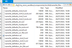
Hi oleson, thanks for your answer. The blank space should be the problem of pasting, I tried this method again, and the new error is shown in Figure 1. Then try what you said I in simple way. But I didn't find namelist_definition_ctsm XML file, my path is/CESM2 / my_cesm_sandbox/components/CLM/BLD/namelist_files
The files inside are shown in Figure 2. May I ask if I did not find the correct path?Looking forward to your answer.1.PNG1690338523312.png
 

oleson

Keith Oleson
CSEG and Liaisons
Staff member
For the version of the model you appear to be using, you would modify namelist_definition_clm4_5.xml.
You may need to download the mapping files to your inputdata.
 

lby

lby
Member
For the version of the model you appear to be using, you would modify namelist_definition_clm4_5.xml.
You may need to download the mapping files to your inputdata.
Thank you oleson, I modified namelist_definition_clm4_5.xml as shown in Figure 1, 2.PNG

but there were also the above errors as shown in Figure 2, 3.PNG

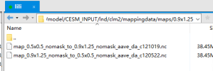
what data should I download if I look at the specific missing data? I am looking for in the original input data path is: CESM_INPUT/LND/clm2/0.9 x1.25 mappingdata/maps /
The data shown in Figure 3 already exists.
4.PNG

Looking forward to your reply!
 

oleson

Keith Oleson
CSEG and Liaisons
Staff member
These are the mapping files that are required when I run this with release-cesm2.1.3:

mksrf_fgrid = '/glade/p/cesm/cseg/inputdata/lnd/clm2/mappingdata/maps/0.9x1.25/map_0.25x0.25_MODIS_to_0.9x1.25_nomask_aave_da_c170321.nc'
map_fpft = '/glade/p/cesm/cseg/inputdata/lnd/clm2/mappingdata/maps/0.9x1.25/map_0.25x0.25_MODIS_to_0.9x1.25_nomask_aave_da_c170321.nc'
map_fglacier = '/glade/p/cesm/cseg/inputdata/lnd/clm2/mappingdata/maps/0.9x1.25/map_3x3min_GLOBE-Gardner_to_0.9x1.25_nomask_aave_da_c120923.nc'
map_fglacierregion = '/glade/p/cesm/cseg/inputdata/lnd/clm2/mappingdata/maps/0.9x1.25/map_10minx10min_topo_to_0.9x1.25_aave_da_110630.nc'
map_fsoicol = '/glade/p/cesm/cseg/inputdata/lnd/clm2/mappingdata/maps/0.9x1.25/map_0.25x0.25_MODIS_to_0.9x1.25_nomask_aave_da_c170321.nc'
map_furban = '/glade/p/cesm/cseg/inputdata/lnd/clm2/mappingdata/maps/0.9x1.25/map_3x3min_LandScan2004_to_0.9x1.25_nomask_aave_da_c120522.nc'
map_fmax = '/glade/p/cesm/cseg/inputdata/lnd/clm2/mappingdata/maps/0.9x1.25/map_3x3min_USGS_to_0.9x1.25_nomask_aave_da_c120926.nc'
map_forganic = '/glade/p/cesm/cseg/inputdata/lnd/clm2/mappingdata/maps/0.9x1.25/map_5x5min_ISRIC-WISE_to_0.9x1.25_nomask_aave_da_c120525.nc'
map_flai = '/glade/p/cesm/cseg/inputdata/lnd/clm2/mappingdata/maps/0.9x1.25/map_0.25x0.25_MODIS_to_0.9x1.25_nomask_aave_da_c170321.nc'
map_fharvest = '/glade/p/cesm/cseg/inputdata/lnd/clm2/mappingdata/maps/0.9x1.25/map_0.25x0.25_MODIS_to_0.9x1.25_nomask_aave_da_c170321.nc'
map_flakwat = '/glade/p/cesm/cseg/inputdata/lnd/clm2/mappingdata/maps/0.9x1.25/map_3x3min_MODIS-wCsp_to_0.9x1.25_nomask_aave_da_c160425.nc'
map_fwetlnd = '/glade/p/cesm/cseg/inputdata/lnd/clm2/mappingdata/maps/0.9x1.25/map_0.5x0.5_lanwat_to_0.9x1.25_aave_da_110307.nc'
map_fvocef = '/glade/p/cesm/cseg/inputdata/lnd/clm2/mappingdata/maps/0.9x1.25/map_0.5x0.5_lanwat_to_0.9x1.25_aave_da_110307.nc'
map_fsoitex = '/glade/p/cesm/cseg/inputdata/lnd/clm2/mappingdata/maps/0.9x1.25/map_5minx5min_soitex_to_0.9x1.25_aave_da_110722.nc'
map_furbtopo = '/glade/p/cesm/cseg/inputdata/lnd/clm2/mappingdata/maps/0.9x1.25/map_10minx10min_topo_to_0.9x1.25_aave_da_110630.nc'
map_fgdp = '/glade/p/cesm/cseg/inputdata/lnd/clm2/mappingdata/maps/0.9x1.25/map_0.5x0.5_lanwat_to_0.9x1.25_aave_da_110307.nc'
map_fpeat = '/glade/p/cesm/cseg/inputdata/lnd/clm2/mappingdata/maps/0.9x1.25/map_0.5x0.5_lanwat_to_0.9x1.25_aave_da_110307.nc'
map_fsoildepth = '/glade/p/cesm/cseg/inputdata/lnd/clm2/mappingdata/maps/0.9x1.25/map_5x5min_ORNL-Soil_to_0.9x1.25_nomask_aave_da_c170706.nc'
map_fabm = '/glade/p/cesm/cseg/inputdata/lnd/clm2/mappingdata/maps/0.9x1.25/map_0.5x0.5_lanwat_to_0.9x1.25_aave_da_110307.nc'
 

lby

lby
Member
These are the mapping files that are required when I run this with release-cesm2.1.3:

mksrf_fgrid = '/glade/p/cesm/cseg/inputdata/lnd/clm2/mappingdata/maps/0.9x1.25/map_0.25x0.25_MODIS_to_0.9x1.25_nomask_aave_da_c170321.nc'
map_fpft = '/glade/p/cesm/cseg/inputdata/lnd/clm2/mappingdata/maps/0.9x1.25/map_0.25x0.25_MODIS_to_0.9x1.25_nomask_aave_da_c170321.nc'
map_fglacier = '/glade/p/cesm/cseg/inputdata/lnd/clm2/mappingdata/maps/0.9x1.25/map_3x3min_GLOBE-Gardner_to_0.9x1.25_nomask_aave_da_c120923.nc'
map_fglacierregion = '/glade/p/cesm/cseg/inputdata/lnd/clm2/mappingdata/maps/0.9x1.25/map_10minx10min_topo_to_0.9x1.25_aave_da_110630.nc'
map_fsoicol = '/glade/p/cesm/cseg/inputdata/lnd/clm2/mappingdata/maps/0.9x1.25/map_0.25x0.25_MODIS_to_0.9x1.25_nomask_aave_da_c170321.nc'
map_furban = '/glade/p/cesm/cseg/inputdata/lnd/clm2/mappingdata/maps/0.9x1.25/map_3x3min_LandScan2004_to_0.9x1.25_nomask_aave_da_c120522.nc'
map_fmax = '/glade/p/cesm/cseg/inputdata/lnd/clm2/mappingdata/maps/0.9x1.25/map_3x3min_USGS_to_0.9x1.25_nomask_aave_da_c120926.nc'
map_forganic = '/glade/p/cesm/cseg/inputdata/lnd/clm2/mappingdata/maps/0.9x1.25/map_5x5min_ISRIC-WISE_to_0.9x1.25_nomask_aave_da_c120525.nc'
map_flai = '/glade/p/cesm/cseg/inputdata/lnd/clm2/mappingdata/maps/0.9x1.25/map_0.25x0.25_MODIS_to_0.9x1.25_nomask_aave_da_c170321.nc'
map_fharvest = '/glade/p/cesm/cseg/inputdata/lnd/clm2/mappingdata/maps/0.9x1.25/map_0.25x0.25_MODIS_to_0.9x1.25_nomask_aave_da_c170321.nc'
map_flakwat = '/glade/p/cesm/cseg/inputdata/lnd/clm2/mappingdata/maps/0.9x1.25/map_3x3min_MODIS-wCsp_to_0.9x1.25_nomask_aave_da_c160425.nc'
map_fwetlnd = '/glade/p/cesm/cseg/inputdata/lnd/clm2/mappingdata/maps/0.9x1.25/map_0.5x0.5_lanwat_to_0.9x1.25_aave_da_110307.nc'
map_fvocef = '/glade/p/cesm/cseg/inputdata/lnd/clm2/mappingdata/maps/0.9x1.25/map_0.5x0.5_lanwat_to_0.9x1.25_aave_da_110307.nc'
map_fsoitex = '/glade/p/cesm/cseg/inputdata/lnd/clm2/mappingdata/maps/0.9x1.25/map_5minx5min_soitex_to_0.9x1.25_aave_da_110722.nc'
map_furbtopo = '/glade/p/cesm/cseg/inputdata/lnd/clm2/mappingdata/maps/0.9x1.25/map_10minx10min_topo_to_0.9x1.25_aave_da_110630.nc'
map_fgdp = '/glade/p/cesm/cseg/inputdata/lnd/clm2/mappingdata/maps/0.9x1.25/map_0.5x0.5_lanwat_to_0.9x1.25_aave_da_110307.nc'
map_fpeat = '/glade/p/cesm/cseg/inputdata/lnd/clm2/mappingdata/maps/0.9x1.25/map_0.5x0.5_lanwat_to_0.9x1.25_aave_da_110307.nc'
map_fsoildepth = '/glade/p/cesm/cseg/inputdata/lnd/clm2/mappingdata/maps/0.9x1.25/map_5x5min_ORNL-Soil_to_0.9x1.25_nomask_aave_da_c170706.nc'
map_fabm = '/glade/p/cesm/cseg/inputdata/lnd/clm2/mappingdata/maps/0.9x1.25/map_0.5x0.5_lanwat_to_0.9x1.25_aave_da_110307.nc'
Thank you for the information, oleson. I have downloaded these files, but I do not have permission to upload these files to the default input dataset because I am using the public server of my tutor so as not to affect the use of others. May I ask where should I change the default path of the files? I just want to specify the path to these files and leave everything else the same. Is that possible?
 

oleson

Keith Oleson
CSEG and Liaisons
Staff member
I imagine you might be able to change this line in mksurfdata.pl:

my $CSMDATA = "/glade/p/cesm/cseg/inputdata"

Or run mksurfdata.pl with -debug which will generate a namelist file and then change the namelist file. Then run:

./mksurfdata_map < *.namelist
 

lby

lby
Member
I imagine you might be able to change this line in mksurfdata.pl:

my $CSMDATA = "/glade/p/cesm/cseg/inputdata"

Or run mksurfdata.pl with -debug which will generate a namelist file and then change the namelist file. Then run:

./mksurfdata_map < *.namelist
Thank you, oleson. However, due to the server permissions I was using, I was unable to modify and upload the required input data. I want to modify the albedo of an area of the Earth's surface. Is there any way to do that? Look forward to your help
 
Status
Not open for further replies.
Top