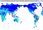
Hi, in daily and monthly GSSUN and GSSHA output I see rather strong artefacts in spatial patterns (e.g. Africa in figure below). I can't think of why this physically should be occurring. I don't see it in the local noon equivalents of these variables. Any insight would be appreciated. I'm using CESM2.1.3 code out-of-the-box.


