Scheduled Downtime
On Tuesday 24 October 2023 @ 5pm MT the forums will be in read only mode in preparation for the downtime. On Wednesday 25 October 2023 @ 5am MT, this website will be down for maintenance and expected to return online later in the morning.
Normal Operations
The forums are back online with normal operations. If you notice any issues or errors related to the forums, please reach out to help@ucar.edu

Calculating change in area of PFTs in CLM5

James King

James King
Member
Hi all,

I am trying to calculate the change in forest area in various domains that CLM5 simulates under the various scenarios produced for CMIP6. I am using the file 'landuse.timeseries_0.9x1.25_SSP1-2.6_78pfts_CMIP6_simyr1850-2100_c190214.nc'.

Currently, I am doing this by multiplying grid cell area by PFT type and dividing by the land fraction, i.e.

AREA* PCT_NAT_PFT/100*LANDFRAC_PFT (for a given domain)

then calculating the area-weighted mean of the resulting field using CDO, adding together all the tree PFTs, and plotting. The shape of the curve looks right, but the area units don't and I am not sure why. Is this method correct or is there a better way to do this sort of thing?

Thanks,

James
 

lawrencepj1

Peter Lawrence
New Member
Hi James,

This is the correct method for calculating areas from the landuse time series file. The area is in km^2 so that may be the problem. Today is a holiday in the US for 4th of July so sorry on the slow response.

Peter
 

James King

James King
Member
Hi Peter,

Thanks! IDL and Python scripts that allegedly do the same thing are giving different values for the area. Good to know I'm on the right track though, and apologies for not remembering the date!

James
 

lawrencepj1

Peter Lawrence
New Member
Hi James

Sorry I just remembered you need to calculate the PCT_NATVEG as part of this calculation. As this is not on the file you need to take this as PCT_NATVEG = 100.0 - PCT_CROP (for the year from the landuse timeseries file) - PCT_GLACIER - PCT_LAKE - PCT_WETLAND (all on the surface data file).

So the area of a PFT should be = LANDFRAC_PFT*AREA* PCT_NATVEG[year] * PCT_NAT_PFT[year]/100

The LANDFRAC_PFT is simply the landfrac calculated for the land model which can be different to the land frac calculated for the ocean model (different resolutions and practicalities of modeling the ocean).

cheers
Peter
 

lawrencepj1

Peter Lawrence
New Member
So the area of a PFT should be = LANDFRAC_PFT*AREA* PCT_NATVEG[year] / 100 * PCT_NAT_PFT[year]/100

forgot the second / 100 ;-)
 

James King

James King
Member
Thanks for this Peter. Is the correct surface data file for this run the one from 1850, 2000, or 2014? I.e.

surfdata_0.9x1.25_hist_78pfts_CMIP6_simyr1850_c190214.nc
surfdata_0.9x1.25_hist_78pfts_CMIP6_simyr2000_c190214.nc
surfdata_0.9x1.25_hist_78pfts_CMIP6_simyr2014_c190516.nc
 

lawrencepj1

Peter Lawrence
New Member
Hi James

For your analysis the surface data for the glacier, lake and wetland should all be the same. Just make sure you have the same surface data file date as the time series. ie c190214 dates should match as well as the resolution etc.

Peter
 

James King

James King
Member
Hi Peter,

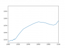
Having done this calculation, the results for North America still seem to have dubious units for area - not sure this is km^2...

n_america_forests.png
 

lawrencepj1

Peter Lawrence
New Member
Hi James

Not sure how you are doing your regional subsetting but here is python code for global area of all trees in km2

print("Reading File: " + surfacefilename)
surfacefile = netcdf4.Dataset(surfacefilename,'r')

inlandfrac=np.asfarray(surfacefile.variables["LANDFRAC_PFT"][:,:],np.float64)
inlandmask=np.asfarray(surfacefile.variables["PFTDATA_MASK"][:,:],int)
inarea=np.asfarray(surfacefile.variables["AREA"][:,:],np.float64)
inlandarea = inlandfrac * inarea
inlonxy = np.asfarray(surfacefile.variables["LONGXY"][:,:],np.float64)
inlon = inlonxy[0,:]
inlatxy = np.asfarray(surfacefile.variables["LATIXY"][:,:],np.float64)
inlat = inlatxy[:,0]
ninlat = inlat.size
ninlon = inlon.size
inpctglacier = np.asfarray(surfacefile.variables["PCT_GLACIER"][:,:],np.float64)
inpctlake = np.asfarray(surfacefile.variables["PCT_LAKE"][:,:],np.float64)
inpctwetland = np.asfarray(surfacefile.variables["PCT_WETLAND"][:,:],np.float64)
inpcturbansub = np.asfarray(surfacefile.variables["PCT_URBAN"][:,:,:],np.float64)
inpcturban = inpcturbansub.sum(axis=0)

surfacefile.close()

print("Reading File: " + landusefilename)
landusefile = netcdf4.Dataset(landusefilename,'r')

# variableunits = inputfile.variables[pftname].units
inpctcrop = np.asfarray(landusefile.variables["PCT_CROP"][startyearindex:endyearindex+1,:,:],np.float64)
variabletype = landusefile.variables["PCT_NAT_PFT"].datatype
# variablelongname = landusefile.variables[pftname].long_name
# variablefillvalue = landusefile.variables["PCT_NAT_PFT"]._FillValue
variablevalues = np.zeros(shape=(numyears,ninlat,ninlon),dtype=float)
for pftidindex in range(numpftids):
pftid = pftids[pftidindex]
pftvalues = np.asfarray(landusefile.variables["PCT_NAT_PFT"][startyearindex:endyearindex+1,pftid,:,:],variabletype)
variablevalues += pftvalues
landusefile.close()

outresults = np.zeros(numyears,dtype=np.float64)
for yearindex in range(numyears):
inpctcropyear = inpctcrop[yearindex,:,:]
inpctnatveg = 100 - inpctglacier - inpctlake - inpctwetland - inpcturban - inpctcropyear
innatvegfrac = inpctnatveg / 100.0
variablevaluesyear = variablevalues[yearindex,:,:]
variablevaluesyeararea = inlandfrac * innatvegfrac * variablevaluesyear / 100.0 * inarea
outresults[yearindex] = variablevaluesyeararea.sum(axis=0).sum(axis=0)
outputfilename = str(sys.argv[5]) + ".csv"
outputstr = "{0:.3f}"

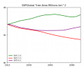
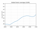
This produces the following plot in km^2 note scaled by 0.000001 to be millions

1626369629569.png
 

Hemraj

Hemraj Bhattarai
Member
Hi James

Sorry I just remembered you need to calculate the PCT_NATVEG as part of this calculation. As this is not on the file you need to take this as PCT_NATVEG = 100.0 - PCT_CROP (for the year from the landuse timeseries file) - PCT_GLACIER - PCT_LAKE - PCT_WETLAND (all on the surface data file).

So the area of a PFT should be = LANDFRAC_PFT*AREA* PCT_NATVEG[year] * PCT_NAT_PFT[year]/100

The LANDFRAC_PFT is simply the landfrac calculated for the land model which can be different to the land frac calculated for the ocean model (different resolutions and practicalities of modeling the ocean).

cheers
Peter
Hi Peter,
Do we also need to consider PCT_URBAN when we calculate PCT_NATVEG?
 

HazelMooney

Hazel Mooney
New Member
Hi James

Sorry I just remembered you need to calculate the PCT_NATVEG as part of this calculation. As this is not on the file you need to take this as PCT_NATVEG = 100.0 - PCT_CROP (for the year from the landuse timeseries file) - PCT_GLACIER - PCT_LAKE - PCT_WETLAND (all on the surface data file).

So the area of a PFT should be = LANDFRAC_PFT*AREA* PCT_NATVEG[year] * PCT_NAT_PFT[year]/100

The LANDFRAC_PFT is simply the landfrac calculated for the land model which can be different to the land frac calculated for the ocean model (different resolutions and practicalities of modeling the ocean).

cheers
Peter
Hi Peter,

I'd like to ask about how these calculations correspond to CLM4.5. I have been trying to unravel discrepancies in my area calculations for a little while. The discussion about for CLM5 above makes me wonder if there is a factor missing from my calculations for CLM4.5

In CLM4.5, my understanding is that we do not have PCT_CROP or PCT_NAT_PFT, we have PCT_PFT which has PFTs for crops within it. To calculate the area of a given PFT, i use: LANDFRAC_PFT*AREA*PCT_PFT/100

Am i missing a step?

Thanks

Hazel
 

slevis

Moderator
I think that this makes sense, but I'm not looking at a clm45 fsurdat file right now. To confirm, I recommend looking at how things add up in a default clm45 fsurdat file, rather than in one that you have modified.

A caveat to point out... I'm pretty sure that LANDFRAC_PFT is not identical to the land area where the model runs. The latter should appear in your history output. Depending on what you want to calculate, LANDFRAC_PFT may or may not be the variable to use.
 
Top