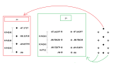
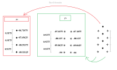
1. I think we answered your question about how to create a domain file for your 1deg atmospheric forcing data already, right?
"To create a domain file, as detailed in the link you shared, you basically need to create a SCRIP grid file and a SCRIP mapping file that can be used as input to gen_domain. Generally speaking, you could use components/clm/tools/mkmapgrids/components/clm/tools/mkmapgrids/mkscripgrid.ncl to create the SCRIP grid file, then cime/tools/mapping/gen_mapping_files/gen_ESMF_mapping_file/create_ESMF_map.sh to create the mapping file, and then cime/tools/mapping/gen_domain_files/gen_domain to create the domain file. Another option is to create a domain file using an offline script following the structure of the GSWP3 domain file example given above."
And I think we already answered your question about how to use your own atmospheric files:
"Basically, the datm is controlled by these files (at least in release-cesm2.1.5) that can be found in the CaseDocs directory in your case directory for a transient run:
datm_in
datm.streams.txt.CLMGSWP3v1.Precip
datm.streams.txt.CLMGSWP3v1.Solar
datm.streams.txt.CLMGSWP3v1.TPQW
datm.streams.txt.co2tseries.20tr
datm.streams.txt.presaero.trans_1850-2000
datm.streams.txt.topo.observed
To use your own atmospheric forcing, you need to modify those files, in particular, for 6-hourly meteorological forcing, the first four files.
You do this by copying those files into your case directory and pre-pending "user_" to the file names.
A snippet of the Precip file should look like this by default (GSWP3 is the default atmospheric forcing):
<?xml version="1.0"?>
<file id="stream" version="1.0">
<dataSource>
GENERIC
</dataSource>
<domainInfo>
<variableNames>
time time
xc lon
yc lat
area area
mask mask
</variableNames>
<filePath>
/glade/campaign/cesm/cesmdata/inputdata/atm/datm7/atm_forcing.datm7.GSWP3.0.5d.v1.c170516
</filePath>
<fileNames>
domain.lnd.360x720_gswp3.0v1.c170606.nc
</fileNames>
</domainInfo>
<fieldInfo>
<variableNames>
PRECTmms precn
</variableNames>
<filePath>
/glade/campaign/cesm/cesmdata/inputdata/atm/datm7/atm_forcing.datm7.GSWP3.0.5d.v1.c170516/Precip
</filePath>
<fileNames>
clmforc.GSWP3.c2011.0.5x0.5.Prec.1901-01.nc
clmforc.GSWP3.c2011.0.5x0.5.Prec.1901-02.nc
...
So you'll need to replace this with your own domain file, path to your forcing files, and your forcing files."
2. No, landuse timeseries files are not like streams files, you can't assign start and end years. If you are going to run a simulation from a start year to an end year, then the file will need to contain all of the years.
3. The "surfdata.pftdyn" files you are pointing to are transient landcover datasets. In older code, they were pointed to by "fpftdyn" in lnd_in, now it is called flanduse_timeseries in lnd_in. Whether you can directly use them in newer code is unknown.


