Scheduled Downtime
On Tuesday 24 October 2023 @ 5pm MT the forums will be in read only mode in preparation for the downtime. On Wednesday 25 October 2023 @ 5am MT, this website will be down for maintenance and expected to return online later in the morning.
Normal Operations
The forums are back online with normal operations. If you notice any issues or errors related to the forums, please reach out to help@ucar.edu

How to modify PFTS in CLM5.0?

zqzq

zqzqzqzq
Member
Dear all,

I have the following three questions for your advice,1. Which file in the surface data generated by CLM5.0 contains the vegetation type of the underlying surface for single-point simulation? 2. Which one of PFTDATA_MASK, PCT_NAT_PFT, LANDFRAC_PFT? 3.If the PFTS in the surface data does not match the actual situation, can you directly modify the values of the PFTS-related variables in the two nc files surfdata_1x1_PAILONG_simyr2000.nc and surfdata_1x1_PAILONG_simyr1850.nc


Thanks Reply
 

oleson

Keith Oleson
CSEG and Liaisons
Staff member
1. The file pointed to by fsurdat in the lnd_in namelist is the surface data file that contains vegetation type, etc.
2. PCT_NAT_PFT
3. Yes. Keep in mind the following rules:

PCT_CROP
PCT_NATVEG
PCT_LAKE
PCT_WETLAND
PCT_GLACIER
PCT_URBAN

The sum of these has to equal 100% at each gridcell. Note that unlike other landunits, there are up to three urban landunits per gridcell.

Also on the surface dataset is:

PCT_CFT

The sum of the two crops types (15 - C3 Unmanaged Rainfed Crop and 16 - C3 Unmanaged Irrigated Crop) must equal 100%, even for gridcells where PCT_CROP is zero (in this case crop type 15 is set to 100% and crop type 16 is set to 0%). These two crop types represent the non-irrigated/irrigated fractions on the crop landunit given by PCT_CROP.

Also on the surface dataset is:

PCT_NAT_PFT

The sum of these must equal 100%. They represent the fractions of pfts on the natural vegetated landunit given by PCT_NATVEG.
 

zqzq

zqzqzqzq
Member
1. The file pointed to by fsurdat in the lnd_in namelist is the surface data file that contains vegetation type, etc.
2. PCT_NAT_PFT
3. Yes. Keep in mind the following rules:

PCT_CROP
PCT_NATVEG
PCT_LAKE
PCT_WETLAND
PCT_GLACIER
PCT_URBAN

The sum of these has to equal 100% at each gridcell. Note that unlike other landunits, there are up to three urban landunits per gridcell.

Also on the surface dataset is:

PCT_CFT

The sum of the two crops types (15 - C3 Unmanaged Rainfed Crop and 16 - C3 Unmanaged Irrigated Crop) must equal 100%, even for gridcells where PCT_CROP is zero (in this case crop type 15 is set to 100% and crop type 16 is set to 0%). These two crop types represent the non-irrigated/irrigated fractions on the crop landunit given by PCT_CROP.

Also on the surface dataset is:

PCT_NAT_PFT

The sum of these must equal 100%. They represent the fractions of pfts on the natural vegetated landunit given by PCT_NATVEG.
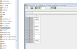
thank you for your reply,The underlying surface of the research site I use CLM5.0 for single-point simulation is only grass,But the terrain data generated by clm5.0 is shown in the attached picture,In order to match the actual situation, do I need to set the value of non-polar C3 grassland in PFTS to 100?As you said, do I only need to modify this nc file directly to complete this operation?
 

Attachments

  • 111(1).png
    111(1).png
    31.9 KB · Views: 29

oleson

Keith Oleson
CSEG and Liaisons
Staff member
If you want only grassland, then you may also need to set PCT_NATVEG to 100% (and any other non-zero landunits to 0%).
 
Top