Scheduled Downtime
On Tuesday 24 October 2023 @ 5pm MT the forums will be in read only mode in preparation for the downtime. On Wednesday 25 October 2023 @ 5am MT, this website will be down for maintenance and expected to return online later in the morning.
Normal Operations
The forums are back online with normal operations. If you notice any issues or errors related to the forums, please reach out to help@ucar.edu

How select a special region to run the CLM from the global model in CLM?

oleson

Keith Oleson
CSEG and Liaisons
Staff member
Unfortunately, there are no formal detailed instructions yet for running with custom atmospheric forcing data. However, as I mentioned there are instructions within the user_nl_datm_streams file on how to modify the streams for your own forcing.
There is a general description of the datm here:


A recent case that I have run that required user modifications to the streams file is here:

/glade/work/oleson/ctsm5.3.0/cime/scripts/ctsm530_f19_PPE_hist

The case was setup with

./create_newcase --case ctsm530_f19_PPE_hist --compset HIST_DATM%CRUv7_CLM60%BGC_SICE_SOCN_MOSART_SGLC_SWAV --res f19_g17 --run-unsupported

The modifications for a custom datm forcing can be found in the user_nl_datm_streams file.
 

jteymoori

Javad Teymoori
Member
Dear Oleson
I compared your case (ctsm530_f19_PPE_hist) with my case. My user_nl_datm_streams file is empty, so I defined my new atmospheric data, including path, mesh file, and datavars in user_nl_datm_streams file. My new atmospheric forcing data, including Precipitation, Solar, and TPQWL for 2005-01 to 2009-12. there is an example of my changing in user_nl_datm_streams file:

CLMGSWP3v1.Solar:datafiles=/glade/derecho/scratch/jteymoori/Daymet4/Data/atm/datm7/Solar/clmforc.Daymet4.0.05x0.05.Solar.2005-01.nc,/glade/derecho/scratch/jteymoori/Daymet4/Data/atm/datm7/Solar/clmforc.Daymet4.0.05x0.05.Solar.2005-02.nc .......
CLMGSWP3v1.Solar:meshfile=/glade/work/jteymoori/CTSM/tools/site_and_regional/subset_data_regional/lnd_mesh.nc
CLMGSWP3v1.Solar:datavars= FSDS Faxa_swdn

CLMGSWP3v1.Precip:datafiles=/glade/derecho/scratch/jteymoori/Daymet4/Data/atm/datm7/Precip/clmforc.Daymet4.0.05x0.05.Prec.2005-01.nc,/glade/derecho/scratch/jteymoori/Daymet4/Data/atm/datm7/Precip/clmforc.Daymet4.0.05x0.05.Prec.2005-02.......
CLMGSWP3v1.Precip:meshfile=/glade/work/jteymoori/CTSM/tools/site_and_regional/subset_data_regional/lnd_mesh.nc
CLMGSWP3v1.Precip:datavars= PRECTmms Faxa_precn

CLMGSWP3v1.TPQW:datafiles=/glade/derecho/scratch/jteymoori/Daymet4/Data/atm/datm7/TPHWL/clmforc.Daymet4.0.05x0.05.TPQWL.2005-01.nc,/glade/derecho/scratch/jteymoori/Daymet4/Data/atm/datm7/TPHWL/clmforc.Daymet4.0.05x0.05.TPQWL.2005-02.n
CLMGSWP3v1.TPQW:meshfile=/glade/work/jteymoori/CTSM/tools/site_and_regional/subset_data_regional/lnd_mesh.nc
CLMGSWP3v1.TPQW:datavars = QBOT Sa_shum,PSRF Sa_pbot,TBOT Sa_tbot,WIND Sa_wind,FLDS Faxa_lwdn


In addition to changing the user_nl_datm_streams file, I changed the datm.streams.xml in the CaseDocs. For this part, I copied my change of datam.streams.xml to the end of this message.

after changing the user_nl_datm_streams and datm.streams.xml, I wanted to submit and run the model with the below scripts:
./xmlchange DATM_MODE=CLMGSWP3v1
./xmlchange DATM_YR_START=2005
./xmlchange DATM_YR_END=2010
./xmlchange RUN_STARTDATE=2005-01-01
./xmlchange STOP_OPTION=nyears
./xmlchange STOP_N=5

./case.build
./case.submit

But after submitting the case I received an email as below:
PBS Job Id: 6601468.desched1
Job Name: st_archive.daily_clm50_ctsm520_0.05x0.05conus_GSWP3V1_2000
Aborted by PBS Server
Job deleted as result of dependency on job 6601467.desched1


Questions:

1- I want to know what is wrong and why my Job was deleted.?
2- Since I want to run the model with 0.05x0.05 degree, for my previous run, I used the 0.05x0.05conus_GSWP3V1_2000 surface data set for my region (midwest of the U.S.), but the atmospheric forcing data has 0.5 degrees (GSWP3V1). Can I say the model interpolated the atmospheric forcing data from 0.5 degrees to 0.05 degrees, and the model's output is 0.05 degrees?


Changes applied to the datm.streams.xml in the CaseDocs

.Solar
<?xml version="1.0"?>
<file id="stream" version="2.0">
<stream_info name="CLMGSWP3v1.Solar">
<taxmode>cycle</taxmode>
<tintalgo>coszen</tintalgo>
<readmode>single</readmode>
<mapalgo>bilinear</mapalgo>
<dtlimit>1.5</dtlimit>
<year_first>2005</year_first>
<year_last>2010</year_last>
<year_align>2005</year_align>
<vectors>null</vectors>
<meshfile>/glade/work/jteymoori/CTSM/tools/site_and_regional/subset_data_regional/lnd_mesh.nc</meshfile>
<lev_dimname>null</lev_dimname>

<datafiles>
<file>/glade/derecho/scratch/jteymoori/Daymet4/Data/atm/datm7/Solar/clmforc.Daymet4.0.05x0.05.Solar.2005-01.nc</file>
<file>/glade/derecho/scratch/jteymoori/Daymet4/Data/atm/datm7/Solar/clmforc.Daymet4.0.05x0.05.Solar.2005-02.nc</file>
<file>/glade/derecho/scratch/jteymoo.......

</datafiles>

<datavars>
<var>FSDS Faxa_swdn</var>
</datavars>
<offset>0</offset>
</stream_info>


Precipitation:

<stream_info name="CLMGSWP3v1.Precip">
<taxmode>cycle</taxmode>
<tintalgo>nearest</tintalgo>
<readmode>single</readmode>
<mapalgo>bilinear</mapalgo>
<dtlimit>1.5</dtlimit>
<year_first>2005</year_first>
<year_last>2010</year_last>
<year_align>2005</year_align>
<vectors>null</vectors>
<meshfile>/glade/work/jteymoori/CTSM/tools/site_and_regional/subset_data_regional/lnd_mesh.nc</meshfile>
<lev_dimname>null</lev_dimname>

<datafiles>
<file>/glade/derecho/scratch/jteymoori/Daymet4/Data/atm/datm7/Precip/clmforc.Daymet4.0.05x0.05.Prec.2005-01.nc</file>
<file>/glade/derecho/scratch/jteymoori/Daymet4/Data/atm/datm7/Precip/clmforc.Daymet4.0.05x0.05.Prec.2005-02.nc</file>
<file>/glade/derecho/scratch/jteymoo........
</datafiles>

<datavars>
<var>PRECTmms Faxa_precn</var>
</datavars>
<offset>0</offset>
</stream_info>


TPQW

<stream_info name="CLMGSWP3v1.TPQW">
<taxmode>cycle</taxmode>
<tintalgo>linear</tintalgo>
<readmode>single</readmode>
<mapalgo>bilinear</mapalgo>
<dtlimit>1.5</dtlimit>
<year_first>2005</year_first>
<year_last>2010</year_last>
<year_align>2005</year_align>
<vectors>null</vectors>
<meshfile>/glade/work/jteymoori/CTSM/tools/site_and_regional/subset_data_regional/lnd_mesh.nc</meshfile>
<lev_dimname>null</lev_dimname>

<datafiles>
<file>/glade/derecho/scratch/jteymoori/Daymet4/Data/atm/datm7/TPHWL/clmforc.Daymet4.0.05x0.05.TPQWL.2005-01.nc</file>
<file>/glade/derecho/scratch/jteymoori/Daymet4/Data/atm/datm7/TPHWL/clmforc.Daymet4.0.05x0.05.TPQWL.2005-02.nc</file>
<file>/glade/derecho/scratch/jteymoori/Daymet4/Data/atm/datm7/TPH.............
</datafiles>

<datavars>
<var>QBOT Sa_shum</var>
<var>PSRF Sa_pbot</var>
<var>TBOT Sa_tbot</var>
<var>WIND Sa_wind</var>
<var>FLDS Faxa_lwdn</var>
</datavars>
<offset>0</offset>

</stream_info>
 

oleson

Keith Oleson
CSEG and Liaisons
Staff member
1. You need to look at the log files in your run directory to diagnose the problem. The email message you are getting is an indication that the short term archiver failed, which is dependent on the successful completion of your simulation.
2. Yes, you can say that.

"
 

jteymoori

Javad Teymoori
Member
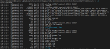
I checked the log files in the run directory ( /glade/derecho/scratch/jteymoori/daily_clm50_ctsm520_0.05x0.05conus_GSWP3V1_2000/run)
1731966129571.png

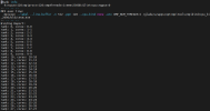
I found that in the mpibind.660147.log and mpibind.5604407.log files the --cpu-bind none .
Do you think my error in running the model is related to this (--cpu-bind none) or to something else?
If this is true, what do you think is the cause of the problem, and how can I solve this error?

1731966717347.png
 

jteymoori

Javad Teymoori
Member
It should be mentioned I know --cpu-bind none it means No CPU binding is specified, and the processes can run on any available core (Default option) but What other possible problems could cause this model not to run?
 

oleson

Keith Oleson
CSEG and Liaisons
Staff member
I see this in your lnd log:

SNICAR ERROR: Absorbed ground radiation not equal to summed snow layer radiatio
n
Diff = -4398046511104.00
sabg_snow(p)= 3.681045188740662E+028
sabg_sum(p) = 3.681045188740661E+028
snl(c) = -1


The magnitude of these values (E+028) can indicate that something is wrong with the forcing. Possibly you are using a missing or fill value as forcing. These values are typically very large, e.g., 1e36.
Your forcing files look like they provide valid values over just land area, which is ok, but the mesh file you are using (/glade/work/jteymoori/CTSM/tools/site_and_regional/subset_data_regional/lnd_mesh.nc) has elementMask set to 1 everywhere, which is telling the datm that all gridcells of the forcing have valid values. elementMask should only be 1 where you have valid forcing values.
 

jteymoori

Javad Teymoori
Member
Dear all
Two weeks ago, I could run the CTSM5.2 with 0.05x0.05 degree resolution (by subset the surface data from 0.05-conus6_data.cfg for my region in the U.S).My model ran well with the default Atmospheric forcing data
Now, I want to create a new case with the same properties and with the same code, without any changes in the code but after submitting the case I received the below email:

PBS Job Id: 7038586.desched1
Job Name: st_archive.Dec1_2daily_clm50_ctsm520_0.05x0.05conus_GSWP3V1_2000
Aborted by PBS Server

Job deleted as result of dependency on job 7038585.desched1

I checked the log file in the run directory and understand that I have an Error in lnd.log.7038585.desched1.241201-193253 as the below:
Input surface dataset is:
/glade/work/jteymoori/CTSM/tools/site_and_regional/subset_data_regional/surfdat
a_Dec1_2daily_hist_2000_78pfts_c241201.nc
This surface dataset is older and incompatible with this version of CTSM
Dataset version = 5.2 Version expected = 5.3
ERROR in surfrdMod.F90 at line 183

ENDRUN:

ERROR: ERROR: Incompatible surface dataset

Has the model had a recent update that caused previous code execution to fail?

The code that I used for my model is:

in derecho

cd /glade/work/jteymoori
git clone GitHub - ESCOMP/CTSM: Community Terrestrial Systems Model (includes the Community Land Model of CESM)
cd CTSM
./bin/git-fleximod update
cp /glade/work/oleson/ctsm5.2.0/tools/site_and_regional/0.05-conus6_data.cfg /glade/work/jteymoori/CTSM/tools/site_and_regional/

cd/CTSM/tools/site_and_reginal
vi 0.05-conus6_data.cfg
[surfdat]
mesh_dir = /glade/work/jteymoori/CTSM/tools/site_and_redional
mesh_surf = /glade/work/jteymoori/CTSM/tools/site_and_redional
Esc
:wq

cp /glade/campaign/cgd/tss/people/oleson/CLM5_datasets/ctsm5.2.0/GLOBAL/surfdata_0.05x0.05-hires_noSP_hist_2005_78pfts_c240516.nc /glade/work/jteymoori/CTSM/tools/site_and_regional

cd /CTSM/cime/scripts
module load conda
conda activate npl
./create_newcase --case ~/Dec1_2daily/Dec1_2daily_clm50_ctsm520_0.05x0.05conus_GSWP3V1_2000 --res CLM_USRDAT --compset 2000_DATM%GSWP3v1_CLM50%BGC-CROP_SICE_SOCN_MOSART_SGLC_SWAV --run-unsupported --project UCNN0040

in Casper


cd CTSM/tools/site_and_regional:
module load conda
conda activate npl
pip install numpy
pip install xarray

./subset_data region --lat1 30 --lat2 50 --lon1 245 --lon2 275 --reg Dec1_2daily --create-surface --crop --cfg-file /glade/work/jteymoori/CTSM/tools/site_and_regional/0.05-conus6_data.cfg --out-surface surfdata_Dec1_2daily_hist_2000_78pfts_c241201.nc
ctsm/tools/site_and_regional/subset_data_regional:
module load nco
cp /glade/work/jteymoori/CTSM/tools/site_and_regional/subset_data_regional/surfdata_Dec1_2daily_hist_2000_78pfts_c241201.nc landmask.nc
ncrename -v .PFTDATA_MASK,landmask landmask.nc
ncks -A -v .PFTDATA_MASK /glade/work/jteymoori/CTSM/tools/site_and_regional/subset_data_regional/surfdata_Dec1_2daily_hist_2000_78pfts_c241201.nc landmask.nc
ncrename -v .PFTDATA_MASK,mod_lnd_props landmask.nc
ncks --rgr infer --rgr scrip=scrip.nc landmask.nc foo.nc
ncap2 -h -A -s 'defdim("lsmpft",79)' surfdata_Dec1_2daily_hist_2000_78pfts_c241201.nc

in derecho

/glade/u/apps/derecho/23.09/spack/opt/spack/esmf/8.6.0/cray-mpich/8.1.27/oneapi/2023.2.1/7haa/bin/ESMF_Scrip2Unstruct scrip.nc lnd_mesh.nc 0

cd case directory:
module load conda
conda activate npl
./xmlchange NTASKS=-4
./xmlchange NTASKS_PER_INST=144
./xmlchange JOB_WALLCLOCK_TIME=12:00:00
./xmlchange JOB_QUEUE=main
./xmlchange PIO_TYPENAME=pnetcdf
./xmlchange STOP_OPTION=nyears
./xmlchange STOP_N=1
./xmlchange LND_NX=25
./xmlchange LND_NY=22
./xmlchange ATM_NX=25
./xmlchange ATM_NY=22
./xmlchange RUN_STARTDATE=2012-01-01

./case.setup

vi user_nl_clm
fsurdat = '/glade/work/jteymoori/CTSM/tools/site_and_regional/subset_data_regional/surfdata_Dec1_2daily_hist_2000_78pfts_c241201.nc'
hist_mfilt=365
hist_nhtfrq=24
hist_empty_htapes = true
hist_fincl1 = 'RAIN','SNOW','QSOIL','QVEGE','QVEGT','H2OSOI','FSH','SOILLIQ','TSL','TSKIN','TSA','TREFMXAV','TREFMNAV'
Esc
:wq

Update lines in env_run.xml:

./xmlchange LND_DOMAIN_MESH=/glade/work/jteymoori/CTSM/tools/site_and_regional/subset_data_regional/lnd_mesh.nc
./xmlchange ATM_DOMAIN_MESH=/glade/work/jteymoori/CTSM/tools/site_and_regional/subset_data_regional/lnd_mesh.nc
./xmlchange MASK_MESH=/glade/work/jteymoori/CTSM/tools/site_and_regional/subset_data_regional/lnd_mesh.nc

./case.build
./case.submit
 

slevis

Moderator
Staff member
The development version of the model gets updated several times per month. Based on the error, you likely updated to a ctsm5.3 tag, while continuing to use a ctsm5.2 fsurdat file. I see two options:
- If you need to run with a ctsm5.3 tag, then you need to generate a new version of your fsurdat file.
- If you do not need to run with a ctsm5.3 tag, then I recommend returning to the version that worked. In this case you do not need to generate a new version of your fsurdat file.
 

slevis

Moderator
Staff member
For the second option that I listed, this is how I checkout a specific tag. I do not know which tag previously worked for you, so this is only for demonstration:

git clone GitHub - ESCOMP/CTSM: Community Terrestrial Systems Model (includes the Community Land Model of CESM) ctsm5.2.005 # puts "master" in a local directory named ctsm5.2.005
cd ctsm5.2.005
git describe # Tells you the tag of your clone of master
git checkout ctsm5.2.005 # Checks out this older tag locally
git switch -c ctsm5.2.005 # Creates a local branch with the same name as the tag
git branch # Lists the local branches and shows which branch you're working on
git describe # Tells you the tag of your branch
 

jteymoori

Javad Teymoori
Member
For the second option that I listed, this is how I checkout a specific tag. I do not know which tag previously worked for you, so this is only for demonstration:

git clone GitHub - ESCOMP/CTSM: Community Terrestrial Systems Model (includes the Community Land Model of CESM) ctsm5.2.005 # puts "master" in a local directory named ctsm5.2.005
cd ctsm5.2.005
git describe # Tells you the tag of your clone of master
git checkout ctsm5.2.005 # Checks out this older tag locally
git switch -c ctsm5.2.005 # Creates a local branch with the same name as the tag
git branch # Lists the local branches and shows which branch you're working on
git describe # Tells you the tag of your branch
Thank you so much for your great help. I used your guidance and solved my problem.

I tried to use my Atmospheric Forcing data to run the ctsm.5.2.005 after submitting my case(Dec5_clm50_ctsm520_0.05x0.05conus_GSWP3V1_2000) I saw that in the run directory in the lnd.log.7071566.desched1.241205-080353, I have an ERROR that shows:

SNICAR ERROR: Absorbed ground radiation not equal to summed snow layer radiation
n
Diff = 1099511627776.00
sabg_snow(p)= 9.601305757368280E+027
sabg_sum(p) = 9.601305757368281E+027
snl(c) = -1
flx_absdv1 = 2.100323353002657E+028
flx_absdv2 = 1.558729555068377E+027
flx_absiv1 = 2.176655650786245E+026
flx_absiv2 = 3.073017118752202E+025
flx_absdn1 = 1.993777798320839E+028
flx_absdn2 = 7.926645724209703E+027
flx_absin1 = 2.032796971198967E+026
flx_absin2 = 8.520030690267909E+025
albgrd_nir = 0.482144264542032
coszen = 1.568990340265444E-002
iam = 0: local column index = 962
iam = 0: global column index = 568052
iam = 0: global landunit index = 204934
iam = 0: global gridcell index = 82295
iam = 0: gridcell longitude = 249.7250000
iam = 0: gridcell latitude = 36.8750000
iam = 0: column type = 219
iam = 0: landunit type = 2
ENDRUN:

ERROR: ERROR in SurfaceRadiationMod.F90 at line 846


1- Based on the observed error, can it be claimed that the model used my Atmospheric Forcing Data, but because these data were still incomplete in some points and had missing values, the model did not run correctly?
2- Will this problem be solved if I use more accurate Atmospheric Forcing Data?

3- Was my approach to changing the Atmospheric Forcing Data correct? (Importing my own Atmospheric Forcing Data into user_nl_streeam and changing their dates in CaseDocs/ datm.streams.xml before submitting the case)
 

oleson

Keith Oleson
CSEG and Liaisons
Staff member
You might have missed my post above which should answer your questions:

"I see this in your lnd log:

SNICAR ERROR: Absorbed ground radiation not equal to summed snow layer radiatio
n
Diff = -4398046511104.00
sabg_snow(p)= 3.681045188740662E+028
sabg_sum(p) = 3.681045188740661E+028
snl(c) = -1


The magnitude of these values (E+028) can indicate that something is wrong with the forcing. Possibly you are using a missing or fill value as forcing. These values are typically very large, e.g., 1e36.
Your forcing files look like they provide valid values over just land area, which is ok, but the mesh file you are using (/glade/work/jteymoori/CTSM/tools/site_and_regional/subset_data_regional/lnd_mesh.nc) has elementMask set to 1 everywhere, which is telling the datm that all gridcells of the forcing have valid values. elementMask should only be 1 where you have valid forcing values."
 

jteymoori

Javad Teymoori
Member
You might have missed my post above which should answer your questions:

"I see this in your lnd log:

SNICAR ERROR: Absorbed ground radiation not equal to summed snow layer radiatio
n
Diff = -4398046511104.00
sabg_snow(p)= 3.681045188740662E+028
sabg_sum(p) = 3.681045188740661E+028
snl(c) = -1


The magnitude of these values (E+028) can indicate that something is wrong with the forcing. Possibly you are using a missing or fill value as forcing. These values are typically very large, e.g., 1e36.
Your forcing files look like they provide valid values over just land area, which is ok, but the mesh file you are using (/glade/work/jteymoori/CTSM/tools/site_and_regional/subset_data_regional/lnd_mesh.nc) has elementMask set to 1 everywhere, which is telling the datm that all gridcells of the forcing have valid values. elementMask should only be 1 where you have valid forcing values."
Thank you for your very effective guidance.
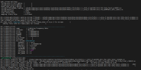
Although I have run the model in an area that has both land and water areas, and the elementMask for them should not be all 0 or 1, I have a question that I see in my lnd.log file in my run directory that even though I have imported my Atmospheric Forcing Data, there is another directory written as Atmosphere (/glade/campaign/cesm/cesmdata/inputdata/atm/datm7/NASA_LIS/clmforc.Li_2012_climo1995-2011.T62.lnfm_Total_c140423.nc). But inside the atm.log file in my run directory there is my Atmospheric Forcing Data (/glade/derecho/scratch/jteymoori/Daymet4/Data/atm/datm7/Solar...) file and another atm file directory (/glade/campaign/cesm/cesmdata/inputdata/atm/cam/chem/trop_mozart_aero/aero/aerosoldep_WACCM.ensmean_monthly_hist_1849-2015_0.9x1.25_CMIP6_c180926.nc).

What is the reason for this difference?
Did the model read my Atmospheric Forcing Data and use them to run, or did it use the data listed in /glade/campaign/cesm/cesmdata/inputdata/atm/cam/chem/trop_mozart_aero/aero/aerosoldep_WACCM.ensmean_monthly_hist_1849-2015_0.9x1.25_CMIP6_c180926.nc or the model used the
/glade/campaign/cesm/cesmdata/inputdata/atm/datm7/NASA_LIS/clmforc.Li_2012_climo1995-2011.T62.lnfm_Total_c140423.nc. to running the model ?
I have attached screenshots of the atm data in the lnd.log and atm.log files in my ran directory.1733513335024.png


1733513181913.png
 

slevis

Moderator
Staff member
There is a very useful command, ncdump, that allows you to look inside the files that you are interested in. This way you can understand the differences between all the files that you asked about.
 

xiaoxiaokuishu

Ru Xu
Member
You might have missed my post above which should answer your questions:

"I see this in your lnd log:

SNICAR ERROR: Absorbed ground radiation not equal to summed snow layer radiatio
n
Diff = -4398046511104.00
sabg_snow(p)= 3.681045188740662E+028
sabg_sum(p) = 3.681045188740661E+028
snl(c) = -1


The magnitude of these values (E+028) can indicate that something is wrong with the forcing. Possibly you are using a missing or fill value as forcing. These values are typically very large, e.g., 1e36.
Your forcing files look like they provide valid values over just land area, which is ok, but the mesh file you are using (/glade/work/jteymoori/CTSM/tools/site_and_regional/subset_data_regional/lnd_mesh.nc) has elementMask set to 1 everywhere, which is telling the datm that all gridcells of the forcing have valid values. elementMask should only be 1 where you have valid forcing values."

This command you've used:

./subset_data region --lat1 30 --lat2 45 --lon1 255 --lon2 270 --reg midwest --create-surface

creates a surface dataset from the global 1deg data by default.
If you want to subset from a different surface dataset, e.g, the global 0.05x0.05, then you need to specify it by modifying the configuration file (default_data_2000.cfg).
I've created a configuration file that will do that. It is here:

/glade/work/oleson/ctsm5.2.0/tools/site_and_regional/0.05-conus6_data.cfg

So try this command:

./subset_data region --lat1 30 --lat2 45 --lon1 255 --lon2 270 --reg midwest --create-surface --crop --cfg-file /glade/work/oleson/ctsm5.2.0/tools/site_and_regional/0.05-conus6_data.cfg --out-surface surfdata_midwest_hist_2000_78pfts_c240628.nc

You may need to run it on casper to get enough memory.
Then you'll need to create new mesh files using the method you used previously.
Hi, Oleson

I hope to create the regional input data for regional simulation, i use the tools,

./subset_data --lat1 -10 --lat2 0 --lon1 100 --lon2 120 --reg SE --dompft 8 --pctpft 100 --create-surface --create-domain --create-datm --datm-syr 2000 --datm-eyr 2000 --create-user-mods --inputdata-dir /work/n02/n02/ruxu/cesm/CESM/cesm_inputdata --outdir /work/n02/n02/ruxu/cesm/CESM/cesm_inputdata/my_data_region --overwrite

But there are no output in datmdata data, I only get surfdata and domainfiles, I did not know if it is a error
or the regional simulation can use global atm forcing?

Best
 

oleson

Keith Oleson
CSEG and Liaisons
Staff member

jteymoori

Javad Teymoori
Member
Hi Oleson
I ran the model with my Atmospheric forcing Data just in the land region but I faced an error in the lnd.log file in the run directory :

problem with limitations on nh4 uptake 0.000000000000000E+000
-Infinity
ENDRUN:
ERROR: too much NH4 uptake predicted by FUN


Why does it happen?
How can I solve this error?
 

jteymoori

Javad Teymoori
Member
It happens because you still haven't fixed your mesh file as noted above.
Thank you for prompt your response
As you noted above, "My forcing files look like they provide valid values over just land area." So, I ran the model just in the land area and used elementMask set to 1 everywhere, but I faced this error.
Did the model use my atmospheric forcing data to run the model at all, and does my problem only relate to the mesh file?
 

oleson

Keith Oleson
CSEG and Liaisons
Staff member
Your problem relates to the datm mesh file. Actually, I see the mesh file you are using to describe the datm forcing grid in your datm.streams.xml:

/glade/work/jteymoori/ctsm5.2.005/CTSM/tools/site_and_regional/subset_data_regional/lnd_mesh.nc

is the mesh for the land grid, i.e., the surface data you are using (200X200 = 40,000).
You need to use a mesh file that describes the datm forcing grid.
Your datm forcing data is

lat = 620 ;
lon = 1160 ;

So you need a mesh file that corresponds to that.
The one you are using has elementCount = 40,000, which is not 620X1160.
So, it's not just that you have a mesh file with elementMask set to 1 everywhere, you also need a completely different datm mesh file.
 

oleson

Keith Oleson
CSEG and Liaisons
Staff member
Can you try using this datm mesh file and let us know if it works:

/glade/work/oleson/ctsm5.3.0/tools/site_and_regional/datm_mesh_cdf5.nc
 
Top